Background on M Street Crashes
While there have been no fatal crashes in the last three years (2023-2025), the M Street pilot area was selected because it is on the DC High Injury Network and given complexity of systemically addressing high-volume, multimodal road safety challenges. There were 213 total crashes that occurred along the M Street corridor between January 1, 2023 and December 31, 2025.
During that period, there were seven suspected serious injuries crashes (3.3% of total crashes) with eight people that were seriously injured. Of the serious injury crashes, three turn hitting vehicle (42.8% of serious injury crashes) and two straight hit non-motorist (28.6% of serious injury crashes) as the leading serious injury collision types. There were 28 crashes that involved a non-motorist (13.1% of total crashes), involving 16 pedestrians (7.5% of total crashes) and 13 bicyclists (6.1% of total crashes). The leading overall collision type within the pilot areas was 58 turning crashes (27.2% of total crashes), with 34 left and 24 right turns. The second leading collision type was side-swipes resulting in 52 collisions (24.4% of total crashes). Passenger cars accounted for 299 vehicles involved in crashes (77.0% of total crashes). The highest percentage of crashes (45.5% of total crashes) occurred in darkness between 18:30 and 7:30 military time EST. In contrast, five serious injury crashes occurred between 11:00 and 16:00 military time EST (71.4% of serious injury crashes). There were six serious injury crashes (85.7% of serious injury crashes) occurred on dates of major events at either Nationals Park or Audi Field. The highest density of overall crashes was in the block of New Jersey Avenue SE and 1st Street SE, however the greatest number of serious injury crashes (28.6% of serious injury crashes) were in the block between 4th Street SE and 5th Street SE, where Van Ness Elementary School is located. While not directly in the pilot area, there were three fatal crashes in the neighborhood from 2023 through 2025. All fatal crashes in the neighborhood resulted in a pedestrian being killed. Those fatal pedestrian crashes were at M Street SW and 6th Street SW on April 16, 2025, at South Capitol and N Street on May 27, 2023, and near 6th Street SE and L Street SE on January 27, 2024 per the DC Vision Zero Crash Locator.
The following crash data sources are hyperlinked so they can be used to further understand crashes happening on the M Street corridor to develop reverse pitches that respond to leading crash factors:
DC Vision Zero Traffic Fatalities and Injuries Website – This website displays traffic fatality and injury crash data across DC, including an interactive Crash Locator map that can be zoomed to M Street to further understand crash locations, modes involved, and crash severity within the pilot area.
Metropolitan Police Department (MPD) Traffic Safety Data Website – This website displays the number of traffic fatalities in all of DC this year, 20-year traffic fatality trends, and links to DC crash data maps and crash details table.
Background on M Street Infrastructure
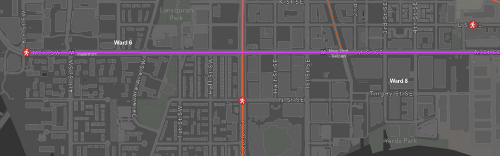
The M Street pilot area is a 25-mile per hour (MPH) street with two lanes of vehicle traffic in each direction divided by a median at most points and center turn lanes approaching most intersections. There are 14 intersections within the M Street pilot area, nine of which are signalized. All other intersections are two way stops from the side streets. The intersection with South Capitol Street SW is especially complex due to the presence of multilevel access lanes, and the intersection with New Jersey Avenue SE presents challenges given high multimodal traffic volumes. There is a bus rapid transit (BRT) lane running westbound from Half Street SW to 5th Street SE, and some on street parking in certain segments during off-peak times, both with right turn mixing zones. There are several bus stops, including a floating bus island on the eastbound side of M Street and New Jersey Avenue SE. Additionally, the Navy Yard – Ballpark Metro Station has entrances on M Street at New Jersey Avenue SE and Half Street SW that result in high volumes of transit riders at those intersections, especially during major events at both Nationals Park and Audi Field.
DDOT installed a multimodal corridor project on M Street SE between Half Street and 12th Street SE that added a bus-only lane, a two-way separated bike lane, signal modifications, curb extensions, access management, and pedestrian safety improvements. The construction began in June 2023 and ended in December 2023. DDOT is currently conducting a before and after analysis for this project and will publish the results in 2027. The crash data provided above does not reflect the effectiveness and/or success of the corridor project completed in 2023.
The M Street pilot area is predominately mixed-use commercial and residential land uses. Key points of interest include the Harris Teeter grocery store at 5th Street SE, the US Department of Transportation (USDOT) headquarters at New Jersey Avenue SE, Washington Canal Park at 2nd St SE, and the Metropolitan Police Department First District Headquarters at 1st Street SW. Van Ness Elementary School at 5th Street SE and the Greenleaf community facilities at Delaware Ave SW both have a 15-MPH school zone speed limit on M Street during school times when flashing.
Existing Physical and Digital Transportation Infrastructure
Current or planned key physical and digital transportation infrastructure to be aware of related to the M Street pilot area include the following:
- The intersections of 1st Street SE and Isaac Hulle Avenue SE on M Street have transit traffic signal priority.
- Most traffic signals on M Street SE are currently set to 120-second cycles during peak hours. The intersections at New Jersey Avenue SE have 90-second cycles to prioritize pedestrians, except on game days.
- There are currently closed-circuit television (CCTV) feeds along the pilot area that may be available by coordinating with RITIS.
- The 1st Street SE intersection currently has a 5G router, however other 5G routers may be available. Fiber is planned but is not guaranteed during this pilot period.
- There is an Automated Vehicle (AV) Monitoring Zone pilot project in the pilot area that will overlap with this pilot.
- There is also a video analytics curbside management pilot project happening on 1st Street SE just off M Street with Automotus that may still be active during this pilot period.
- DDOT is working with Ouster to possibly install LiDAR at New Jersey Avenue SE intersection during this pilot period.
- DDOT is working with Blue Halo to possibly install a vehicle to everything (V2X) roadside unit at New Jersey Avenue SE intersection during this pilot period.